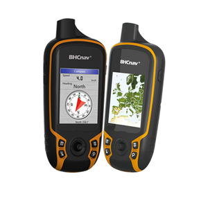
Types of GPS Surveying Equipment
GPS surveying equipment has a myriad of classifications, depending on the precision levels needed. The following are some of the most popular:
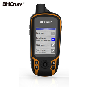
GNSS Receivers
Global Navigation Satellite System (GNSS) receivers are a type of GPS surveying equipment that utilizes multiple satellite systems for positioning. Unlike basic GPS, which mainly uses the U.S. GPS network, GNSS receivers tap into other satellite networks like GLONASS (Russia) and Galileo (Europe). This multi-satellite approach ensures:
- Greater Accuracy: By accessing more satellite signals, the receiver can determine locations with higher precision.
- Improved Reliability: With a broader satellite range, the receiver is less likely to lose signal, even in challenging environments.
- Better Performance in Difficult Terrain: GNSS can provide better tracking in urban areas with tall buildings or in rural regions with heavy tree cover.
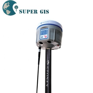
RTK (Real-Time Kinematic) Equipment
RTK stands for real-time kinematic, a surveying method that employs satellite positioning data for high accuracy. It achieves centimeter-level precision by processing the satellite data using base stations. The base stations serve as a known fixed position while the mobile units collect data in the field. Some key features of RTK include:
- RTK equipment can generate real-time corrections, reducing the need for post-processing in a data center.
- The system relies on a base station and rover setup to achieve precise measurements over short distances.
- It is often used for tasks requiring extremely accurate measurements, like boundary surveying and construction staking.
Post-Processed Kinematic (PPK)
A type of kinematic surveying that records the satellite data for later correction using reference data from nearby base stations is known as post-processed kinematic (PPK). Despite the name, PPK still offers near real-time results since the data correction process is quick. PPK is usually applied in:
- Projects with less strict timing requirements, where post-processing of data in a computer suite is feasible.
- Longer survey activities where the precise-correction output makes it easy to avoid returning to the surveying area.
Static GNSS Surveying
Static GNSS Surveying involves tripod-mounted GNSS receivers that log the satellite signals for an extended duration, typically 30 minutes to several hours. Durations this long allow the receivers to lock onto the satellites precisely, which is why it is in the preferred methods for:
- Marker Determination: Offering precise data for determining the fixed points on a wide range of mapping and surveying surfaces.
- High Precision Needs: It achieves accuracy levels at the centimeter or sub-centimeter range by collecting satellite signals for an extended period.
Industry Applications of GPS Surveying Equipment
Land Surveying
GPS Surveying Equipment plays an ever-important role in producing accurate maps, measuring land boundaries, and establishing property lines. Precise positioning and accurate data will give this technology a better stake in its relevance in contemporary surveying. RTK and PPK are especially useful for:
- Boundary Determination: Delivering measurements that help surveyors outline clear and legally verified land boundaries.
- Topographic Mapping:
Assisting surveyors in making detailed maps that present the terrain's height, slopes, and other physical features.
Construction and Civil Engineering
In construction, placing a premium on accuracy, GPS equipment, such as construction laser levels, is used for site grading, foundation layout, and as-built surveys. It helps builders precisely place structures in line with their designs. Specific applications in this domain include:
- Site Grading:Ensuring that the land is moved and shaped precisely as per the engineering plans, thus avoiding excess or shortage of materials.
- Foundation Layout:GPS technology allows engineers to position foundations precisely, ensuring that buildings are stable and aligned correctly.
Agriculture
The use of GPS technology in agriculture has led to a revolution known as precision farming. Some devices, like tractor levels, use satellite positioning to control the exact placement of seeds, fertilizers, and pesticides, which improves productivity while minimizing waste. This technology helps farmers make accurate measurements for:
- Crop Monitoring:Farmers can monitor the health of their crops from various satellites, identifying which areas need water, fertilizer, or attention.
- Field Mapping:Capturing detailed maps of fields that show the various features and conditions of the land, which is essential for planning and analysis.
Transportation and Infrastructure Development
GPS Surveying Equipment also supports the design, construction, and maintenance of roads, bridges, and other transportation structures. It allows civil engineers to map out transportation networks precisely. Key applications include:
- Route Optimization:Providing precise data that helps determine the best and most efficient routes for transportation networks.
- Traffic Management:Enabling real-time tracking and analysis of traffic patterns, which improves the management of existing systems and planning for future ones.
Important Specifications and Features of GPS Surveying Equipment
Key Specifications of GPS Surveying Equipment
Accuracy
Accuracy is the degree to which a measured value is close to the true value. It is one of the most critical parameters in GPS surveying equipment. The level of accuracy required will depend on the specific surveying task. For example, RTK systems can achieve sub-centimeter accuracy, while standard GPS may only reach a few meters.
Precision
It is the degree to which multiple measurements under unchanged conditions are close to each other. In surveying, precision goes hand in hand with accuracy, as highly accurate equipment must also be precise. Precise measurements are critical in land surveying, where slight variations can lead to legal disputes. Likewise, in construction, a lack of precision can result in misaligned structures, leading to increased costs and time wastage.
Resolution
Resolution is the scope of the smallest change or variation that can be perceived by the equipment. In GPS surveying, it pertains to the capability of the system to register the fractional differences in coordinates. Higher resolution means the system can give more detailed and finer measurements. In applications like precision agriculture or hydrographic surveying, high resolution is fundamental as minute discrepancies in data can greatly impact the outcome.
Reliability
It refers to the system's ability to deliver accurate results consistently over time. Environmental conditions such as weather, terrain, and satellite availability can affect the reliability of GPS data. For example, tall buildings or trees may obstruct satellite signals, leading to inaccurate or unreliable measurements. A dependable system will keep working under varied circumstances without considerable deviation in accuracy. This is especially important by contractors in a construction project or in Time-sensitive applications like boundary determination in legal land surveys.
Live Updating
Real-time access to subsystems of GPS surveying is vital in some operations. For instance, RTK systems are widely cherished for they provide immediate satellite corrections, allowing surveyors to take instant and accurate readings. Likewise, in active construction projects, real-time updates enable the workers to constantly check their progress against the design specifications.
How to Choose GPS Surveying Equipment
When selecting a GPS surveying instrument, buyers need to consider many factors. Below are some key ones to bear in mind:
- Precision and Accuracy: Consider the degree of accuracy required for the specific survey. For centimeter-level accuracy, an RTK or PPK system would be useful. For less critical tasks, a standard GPS might suffice.
- Satellite Systems Compatibility: It is important to choose a receiver that supports multiple satellite systems like GNSS and Galileo. This will improve reliability and accuracy, especially in difficult environments.
- Post-Processing Capability: For projects where real-time data isn't critical, a post-processed kinematic (PPK) system can be more accurate and less expensive. These systems use software to process the data later, providing precise corrections.
- Durability and Environmental Rating: Look for equipment that can withstand harsh environmental conditions. Most GPS devices have a specific sustainability grade, such as IP65, which means they are water- and dust-resistant. This is important for usage in rough terrain or adverse weather.
- Ease of Use and Training: Some systems are more user-friendly than others. Simple interfaces and controls can reduce the training time required for new operators. This can also influence productivity, as logistically easy systems allow surveyors to begin surveys very quickly.
- Software Compatibility: Ensure the GPS system is compatible with the existing mapping and surveying software. This will enable the new system to be easily integrated into the current workflow without needing new software purchases.
Q&A
Q1. Which factors should be considered when determining the price of the GPS surveying equipment?
A1. Several factors determine the cost of GPS Surveying Equipment. First, the type of survey affects its price, with RTK and PPK systems gravitating higher than standard GPS. Other factors include the technology used, the degree of precision and accuracy, environmental resistance, and compatibility with surveying software and hardware. Extended warranty and durability also increase their cost. Finally, the brand significantly impacts the equipment's price, with renowned brands usually more expensive than less popular ones.
Q2. What is the importance of calibration in GPS surveying equipment?
A2. Calibration is very important as it ensures the accuracy and precision of the measurements taken throughout the operation. It eliminates the effect of the physical changes that may have happened over time. GPS surveying equipment is normally exposed to tough weather, leading to physical deterioration. Therefore, regular calibration is critical in land surveys and construction, where slight variations can have serious legal or structural implications.
Q3. What is the purpose of maintenance in GPS surveying equipment?
A3. The purpose of maintaining/storing various GPS surveying instruments is to prevent deterioration, ensure their accuracy and precision, and improve their longevity. Proper maintenance also reduces the need for repairs and calibrations. This, in turn, minimizes operational costs and increases the productivity of the surveyors as they have reliable equipment.
Q4. Can GPS surveying equipment be employed indoors?
A4. Although GPS surveying equipment struggles with indoor and underground use because of the weak satellite signals, some advanced systems have augmentations like Wi-Fi or other local positioning systems that ensure they are usable indoors. Further, GNSS receivers are particularly suited because they support several satellites.
Q5. What is the difference between GPS and GNSS?
A5. GPS stands for Global Positioning System. It is a satellite-based navigation system developed by the U.S. government. On the other hand, GNSS — Global Navigation Satellite System — is the intercontinental generic term for satellite-based positioning systems. It comprises systems like GPS, Russia's GLONASS, Europe's Galileo, and China's BeiDou. Thus, GNSS receivers have better accuracy and reliability than GPS alone.


 浙公网安备 33010002000092号
 浙B2-20120091-4